Showing posts with label Flooding. Show all posts

Monday, July 17, 2017

Flood 2017 - Creek Impacts

The July 6 flood certainly had an impact on the creek.  Some sections lost all lose material right down to the bedrock.

Other sections accumulated material brought down from upstream.

Deposition of stone in the creek channel was due to the formation of debris dams that temporarily slowed the speed of the water.  As the water slowed, it lost the energy necessary to carry heavy objects and the gravel dropped out into the creek bed.

Water diverted out of the creek channel carried its sediment load along with it.  A number of sand bars were formed well away from the creek. 

Where the creek left its bed with more momentum, gravel bars were left behind.

There were even a few large flat rocks left stranded far from the creek.

At one bend in the creek the flood water cleaned the face of this bedrock arch.  This feature has never been so easy to view.

Water was deep enough that the meanders in the creek had little effect on the direction of flow.  The current went straight down hill, passing cleanly over every bend and curve in the creek channel.

It was not hard to tell in what direction the water was flowing.  I don’t think a steam roller could have laid these plants down any more than this.  This particular area typically has a nice floral display in late July.  I don’t think that’s going to happen this year.

In the broad, flat areas, water depth peaked at between two and three feet.  It’s going to take a couple of years before the visual effects of this flood event begin to disappear.

Wednesday, July 12, 2017

Flood 2017 - The Storm

Last month I was describing the drought conditions currently being experienced at Blue Jay Barrens. I believe it’s safe to say that that particular period of drought has come to an end. On July 6, Blue Jay Barrens was the recipient of 6+ inches of rain in a period of less than 12 hours. The resulting flood conditions far surpassed anything we have ever experienced here in the past.

The rain began around 1:30 AM and continued until 8:30 AM. During that time approximately 3 ½ inches of rain fell. Our dry soils were able to accommodate most of that water and very little runoff occurred. The weather was clear for the next few hours, until a storm formed over the area around 12:20 PM. During the next hour, 2 ½ inches of rain was added atop soils which had nearly reached their saturation point. Runoff began immediately and the majority of that 2 ½ inches of water flowed overland across the landscape. The video above shows the runoff from a watershed only a few acres in size as it crosses the driveway in front of our house. The video begins during the most intense part of the storm and ends about five minutes after the rain stopped.

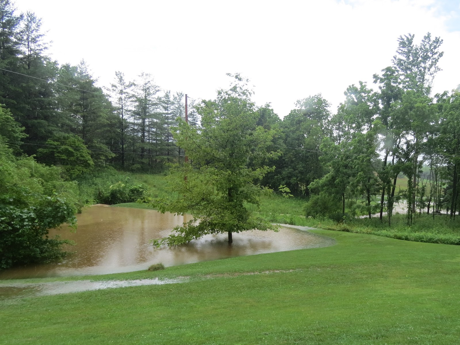
Even though I was dismayed at the magnitude of the disaster unfolding before me, I got some pleasure at viewing the scene shown in the photo above. The clear water coming in from the left is flowing from my field that has been managed for the past 30 years as tallgrass prairie. The muddy water to the right comes from neighboring properties and the Township road. When I first bought this property, all of that runoff water would’ve been muddy. It’s nice to see that my management efforts are having some positive effects.

The former access road, now grassed over, carries the excess floodwater past the prairie display garden and dumps it over the bank into the pond. Water from a more normal runoff event would all have gone through the shrubbery to the right.

With the pond’s primary spillway overloaded, water overtops the dam. This is something that has not occurred since I moved here.

During a year with more typical rainfall, the pond would currently be down to just a puddle and raccoons would be devouring the last of the tadpoles. Gray Treefrog tadpoles generally have a poor time of it in the pond. They breed later than most of the other frogs and the tadpoles generally don’t have time to fully develop before the water disappears. This flood event has been a boon to the Gray Treefrog population.

Thanks to all this water, I’ll be seeing many more of these newly morphed Gray Treefrogs during the next few weeks.

Friday, April 10, 2015

Rain and Flooding

Blue Jay Barrens is about as wet as it can get.  A long sequence of storms moving through during the past week has dropped nearly six inches of rain over the area.  Storm clouds moved through once or twice every day.

The soil, already fully hydrated by over six inches of rain in March, quickly became saturated and the output of each storm had nowhere to go but to run overland to the creek.  A storm yesterday afternoon produced 0.8 inches of rain in 15 minutes.  The result was a flash flood, the third this week.

Water from the township road carried red clay particles to the pond.  It looks like a bowl full of mud, but the water clarity is not as bad as it appears.

A closer examination shows the water to still be fairly clear.  The clay tint makes the dark Wood Frog tadpoles easy to see. 

The tadpoles have just recently taken on the traditional tadpole shape and become free swimming.  If these rains persist, there will be no problem of the pond drying up before the tadpoles transform into little hoppers.

The diversions around the vegetable garden have been working overtime this spring.  The garden sits in a level area that was formed by eroded soil being trapped by an elevated roadway.  Without the diversions, water would inundate the garden after every rain.

After each storm, I check to see that the female Carolina Wolf Spider is alive and well.  So far, she seems to have been unaffected by even the heaviest of rains.

Small upland waterways swell to wide streams as the water quickly rushes downhill.  After each rain event, I try to get down to the creek to see how the increased water flow moves through the channel.

The quickest way to the creek is over the hill.  Even in the driest, most well drained locations, water still stands on the surface.

Five minutes after the rain has stopped, concentrated water flow is still pouring from small woodland watersheds along the creek. 

Water running from these woodland areas is generally clear, but it carries a heavy load of leaves.  The result is a mosaic of bare ground and thick piles of leaves.  This will influence the pattern of plant growth through the rest of the year.

I’m always relieved when I see the bridges still intact.  All but one of the bridges have been replaced to an elevation above the record flood level.  If we do get a flood capable of tearing out this bridge, I hope I’m here to see it, because it will be a truly rare and terrifying event.

Calm and scenic features, such as a small waterfall, are covered over by the flood.  It’s always a surprise when the water drops and the creek resumes its earlier appearance. 

Water pools in the flood plains as it waits for a chance to seep into the ground.  This soil is very well drained and normally allows rapid water infiltration.  Its appearance now makes you think of vernal pools and amphibian breeding, but given a day without more rain, it will pass all of this water into the creek.

This is the last bridge needing to be repaired and elevated.  It has been moved and battered by flood water many times over the years.

Downstream of the bridge is the area blocked by a log jam a couple of years ago.  Since the removal of the jam, water now flows freely through the channel.

Since I wait for the lightning to clear the area before venturing out after a storm, I usually miss seeing the water at its highest level.  At the peak of the flood, water left the creek channel and moved overland.  This area was scoured clean when the water was suddenly blocked by the formation of a log jam and forced out here.  It’s likely that a new channel will be formed here someday.  I could have left the log jam in place and let the new channel form, but this little area has a nice collection of woodland flowers that I would like to enjoy for a while longer.

The third of three large bridges is now well above flood level.  This bridge was repaired using sections of decking from two older bridges.  I think this one is elevated and anchored well enough to withstand any flood.

I find still photos of rapidly moving water to be lacking in impact, so I have included a short video that captures the movement and sound of the angry creek.  It is also available for viewing on YouTube by clicking HERE.

Friday, March 9, 2012

Flood Damage - Plants

My greatest concern following a major flood event is the recovery of the streamside plant communities.  The plants must recover in order for the animals to recover.  Billions of small organisms were swept away with the leaf litter and topsoil.  Those that were left behind have lost the environment they need to survive.  Roots that once gathered nutrients from the decomposing leaves are left exposed to dry out and die.  It could be tough growing for some of the plants this spring.  The bare soil will dry out much more quickly and will heat rapidly when exposed to the sun.  Conditions will improve some when plants grow enough to shade the ground.  Soil creation can begin anew next autumn when falling leaves fill in the space between plants.

While some places lost their topsoil, others gained soil material.  Plants must now push their way up through a thick layer of sediment.

Both situations involve this stuff.  At one point these crumbs were all neatly stacked and arranged to form a cohesive block of soil.  In that condition they provided the structure needed for a healthy soil ecosystem.  Now they’re like shards of glass from a broken drinking glass; Recognizable pieces of what they once were, but no longer functional as a whole.  It will take a long time for these crumbs to be broken down and reformed into healthy soil.

In some cases, leaf litter was also redistributed.  Shallow water flows pushed leaves together to form tightly packed drifts several inches deep.  I moved some leaves aside to show the thickness of this pile and found a plant buried beneath.  Leaves packed at this density can form an effective mulch that blocks the upward movement of growing plants.

These Downy Rattlesnake Plantains were perched at the top of the bank at the high water line.  One still holds the stalk and seed capsules from last year’s flower.

Rhizomes that were just beginning to reach out into the surrounding soil, now have nowhere to go.

Plants farther from the stream were threatened by sheets of water flowing from the hillside.

Some areas closer to the channel hardly seem capable of supporting plants.  Had a logjam not developed directly upstream, there might not have been anything left here.

Just a few feet downstream of the logjam is the site of a single Large Flowered Trillium that has been growing here for about ten years.  It has bloomed several times during that period and flood water has flattened it about an equal number of times.  Hopefully it will be poking its way through in a few weeks.  I sometimes wonder if I should relocate plants growing in such precarious positions, but I figure there must be a reason for the plant to be growing on this site, instead of the many places I believe to be better suited. 

This Swamp Milkweed grows in the center of the creek channel where it’s anchored by one stout root in a crack between the rocks.  Most of its roots are exposed on the creek bed.  I figured it wouldn’t last long at all in this location.  Despite my opinion, the plant has flourished and flowered for the past several years.  It’s occasionally battered by flood water, but it bounces right back up and produces a beautiful floral display.  I’m hoping the rest of the plants along the creek follow its example.

Thursday, March 8, 2012

Flood Damage - Channel

The main creek channel appears untouched by the raging flood waters.  Clear water splashing over clean rocks is normal for this section of the creek.  The difference is that those may not be the same rocks that were there prior to the flood.  As the velocity of flood water increases, its ability to move loose rocks also increases.  At the peak of the flood, rock of various sizes was moving downstream along the entire length of the channel.  When the water slowed, the rocks fell back to the bottom. 
Some areas that had pre-flood bottoms of sand and gravel, now display clean bedrock.
Rock and gravel bars developed where water was temporarily slowed.  This is material that once formed the stream bed somewhere upstream.

The water has to slow even more before the sand settles out.  The Wild Turkeys must have run up and down the creek channel as soon as the water receded.   Maybe they represent the new scourge, Disaster Tourists who turn someone else’s misfortune into an opportunity for a family outing.

This is why it’s a poor survival strategy for Streamside Salamanders to lay their eggs beneath the smaller flat rocks.  It’s hard telling how far this rock traveled before coming to rest on its edge.  If eggs had been attached, they never would have survived the journey.

The most noticeable impact to the stream channel is blockage by debris. 

The blockage usually begins with the accumulation of a couple of large trees or logs.  These in turn catch smaller material until an almost solid structure is in place.  Water is forced to go around or go over.  Water coming over the top of a log jam will create a pool where the water falls on the downstream side.  Pools created in this fashion often contain the last open water before the stream goes dry in the summer.

Leaves and other bits of fine organic matter will quickly decompose.  Unless another flood replenishes the supply of loose material, the structure will be reduced to just the big logs.

In some situations, water is forced beneath the logs.  The pool forms upstream and below the obstruction.  The abundant cover associated with these pools attracts a variety of wildlife species.

Sometimes it’s hard to determine just how the pile-up was created.  The key is usually a tree that has fallen across the creek.  The fallen tree intercepts material being carried down the channel.  It’s difficult to imagine how an entire tree can find its way down such a narrow, winding channel.  In this log jam, the large tree on the right and the long Y-shaped tree with a root ball both came from somewhere upstream.  I hope we’re not destined to experience an even larger flood capable of moving this mess on downstream.