Showing posts with label Geology. Show all posts

Wednesday, October 12, 2011

Breccia Struggles

Blue Jay Barrens has many examples of hostile environments, but the most life unfriendly has got to be the breccia hills. These steep slopes surfaced with rock chips are an almost impossible place for plants to grow. The struggle of plants trying to colonize this rugged area is fascinating.


The breccia is a product of the meteor strike that occurred around 300 million years ago. The strike fractured the limestone and created a mass of rock chips. These chips were then cemented together. Exposure to weather causes the cement to fail and a layer of loose chips is created.


The lack of a soil covering is a product of poor land use practices. During the time of active farming, this area was plowed and the process of erosion was begun. The extent of the erosion was absolute. All of the soil that had been building over thousands of years was lost in just a few decades. If the objective had been to strip the soil from the land, this would be a grand prize winning site.


Beneath the breccia is a more solid layer of limestone. This base gives form to the breccias hills. As the chips break loose, they migrate down the hill. The underlying rock is now exposed in several areas.


The chips don’t go very far. Most are trapped at the base of the hill. Some make it down to the creek where they contribute to the section of gravel bottomed stream.


Some areas still have a bit of subsoil over the breccias. The poor soil is not conducive to rapid plant growth and still shows signs of erosion. Things actually look worse than they are. As the soil eroded, rock chips became exposed on the soil surface. These chips worked to protect the soil from additional erosion. The result is a combination of pebble covered shelves flanked by stone topped columns.


Grass is slowly taking hold on the breccias slopes. It’s a slow process. A severe drought causes many of the young pioneers to die. Excessive rainfall causes enough chip movement to disrupt the growth of small plants. It took many years for these grass plants to become established. They seem to be in good shape now, but their position is far from secure.

Monday, August 1, 2011

Rock Piles

On the upper slopes of an old cedar covered hillside, can be found piles of limestone slabs. The pieces were created when a meteor struck this site hundreds of millions of years ago. They were exposed by erosion resulting from improper land use experienced in the last couple of hundred years. Now they offer another specialized habitat for the creatures of Blue Jay Barrens.


The rock piles are found in a 100 foot wide band that follows the contour for about 900 feet across the south facing slope. The southern aspect allows the rocks to heat quickly on sunny days in late winter and spring. That makes these rock piles an excellent place to search for lizards and snakes coming out of hibernation.


Each pile produces a wide range of caves, cracks, crevices and shelves. Each location provides a variety of temperature and moisture conditions. Here we have a lizard absorbing the heat of a sunny ledge while a turtle squeezes into a cool, shady nook just below.


Each rock pile seems to have a resident Northern Fence Lizard, but I never see more than one lizard per pile. There is a hint of blue coloration at the base of the throat and on the exposed portion of the belly that indicates this individual is a male.


Temperatures in the high 90’s are a bit much for the turtles. This Eastern Box Turtle has squeezed beneath a thick rock overhang to escape the rising sun and benefit by the slightly cooler earth at the base of the rocks. Both the turtle and the lizard are carrying about bits of spider web, so I imagine there are a few spiders making their homes among the rocks. I put my hand beneath the ledge to feel the cool turtle getaway, but I didn’t go sticking my fingers where I couldn’t see.

Thursday, June 30, 2011

Newly Exposed Rock

Heavy spring rains caused flood waters to tear through the creek channels at Blue Jay Barrens. This is a point in the creek where high water slams into a rock wall and makes an abrupt 90 degree turn to the right. Water doesn’t like to turn corners and it expends a lot of its energy by tearing apart the obstacle that makes it do so. I benefit by having freshly exposed rock layers available for my personal viewing.


It’s always fun to examine a new rock face. It’s sometimes hard to comprehend the fact that this material has been hidden below ground for hundreds of millions of years. I feel privileged to be the one to greet it when it is finally exposed to the light.


There’s not much left to the roof of this overhang. The roots that once grew between the rock layers are now hanging down from the ceiling. I’m not sure that the rock is very stable now. I’ll have to remember this spot when I’m walking topside. I don’t want to witness the collapse as part of the falling debris.


The thicker limestone layers are more durable and will last for much longer. The fractures and the tilt to the bedrock are evidence of the prehistoric meteor impact that occurred here roughly 350 million years ago. It makes for some interesting geological finds.


One of the things I find most interesting is the distortion of thin rock layers. When these layers were originally formed they should have been oriented horizontally in parallel bands. The layers I see are rarely like that. I see thin bands that are broken or twisted or stretched or compressed or otherwise reconfigured into a unique pattern. It’s amazing to think of a single event producing enough heat and energy to make the rock malleable enough to shape into a new pattern.


This is one of my new favorites. Looks like someone made up a batch of caramel swirl ice cream. I’m not very knowledgeable about geology, but my niece is a super geologist. I’ll have to get her down here to explain to me what I’m looking at.

Saturday, August 21, 2010

Creek Rocks

When the water disappears from the creek, what’s left is mainly rocks. I don’t know nearly enough about geology. I know the basic rock types and the common minerals and understand the role the bedrock plays in the development of soils and the landscape, but when I look at a jumble of rock such as this, I feel that I’m missing some crucial connection. It doesn’t help that so much of the rock is hidden from view by the plants and soil. The creek is where I go to try for a meaningful bond between myself and the elusive subterranean structures.

The exposed creek bed becomes new territory that can be exploited by pioneering plants. Seeds are constantly being moved downstream by the water. In large creek or river systems, seeds are carried by flood water far out into the floodplains where they can grow and establish new colonies. In small creeks like these, the seeds are more likely to become lodged between the rocks or on the gravel bars. Neither of these locations is ideal for long term survival, so the best chance for developing permanent colonies comes from plants in the creek bed maturing and spreading seed outward to the area immediately above the creek bank. Seed falling into the creek bed will most likely move on downstream.

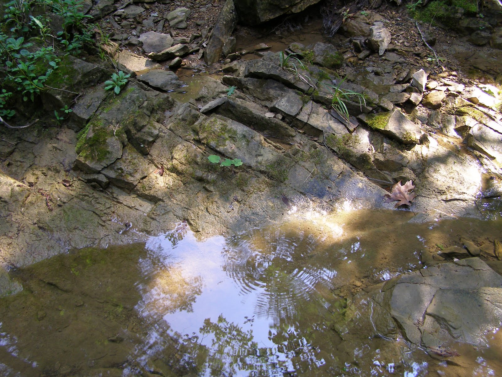
Autumn is the best time to see exposed bedrock features in the creek. Because of the disturbance caused by the meteor impact, most areas appear to be rough and jagged. If I were to put names to these features I would most likely use terms like Gator’s Back or Cat’s Tongue.

Some tilted bedrock slabs are causing the subsurface flow to come to light. This is the trickle of water that is moving through the remaining pools. The water stream is only about two inches across.

I was asked why I spent so much time taking pictures of the creek and I replied that it was the coolest place to be on a hot August day. The big rock slabs bring up the coolness of the earth and when the breeze blows it feels like the flow from an air conditioner. I’m just like any other animal seeking out the most comfortable location.

The unorthodox bedrock in this area results in some pretty odd groundwater patterns. Subsurface water typically follows the plane of the bedrock layers and those layers are expected to closely follow a nearly horizontal orientation. At Blue Jay Barrens, the bedrock may tip in any direction and has many abrupt changes. Downward slanting layers can capture subsurface water and direct the flow deep underground. This means that some sections of the creek can go dry while flow remains both upstream and downstream of the dry section.

Level is not a concept that applies much at Blue Jay Barrens. People sometimes look at my photos and assume that I can’t hold the camera straight. I’m not personally responsible for the tilting bedrock, leaning trees or sloping ground. The tree in the top center background is straight and vertical. By using that tree as a guide, you can see that the camera was level when the shot was taken.

Monday, February 15, 2010

Shale

Any force that can shatter limestone can certainly have its way with soft shale. I’m speaking of the meteor strike and how it rearranged the bedrock of Blue Jay Barrens. Just over the hill from some major limestone outcroppings, we have this exposed bed of shale.

The shale was formed when layers of water sorted clay particles received enough pressure to consolidate them into hard layers. When formed, the layers were oriented horizontally. The meteor strike brought this section around to the vertical. Fractured shale layers arranged vertically makes it much easier for roots to penetrate.

Exposure to the elements results in a constant decomposition of the shale layers. There is a steady procession of chips, grains, and dust moving down the slope below the exposed shale.

Shale is a fascinating rock. Each layer is like a page of a book that can be turned to reveal new secrets. Some of the layers are quite soft and with a little effort can be worked and molded like the original clay from which it was formed. This is a shot of a small piece held in my hand.

This is another hand held piece showing layers that are hard and brittle and can’t be broken by hand. This piece contained a wide range colors and displayed some rusty spots that suggested the presence of iron. Near the center left of the photo there appears to be a small blue-bodied mite with red legs. I was so blinded by the snow while taking these shots that I could barely see the rock in my hand, let alone the mite. I didn’t see him until I downloaded these shots.

The soil here was formed from the shale. The result is a low pH soil with a fairly high clay content. Bedrock type dictates soil type; Soil type dictates plant growth; Plant growth dictates animal populations. What ever you are seeing on the surface is a direct result of what’s underground. To make sound land management decisions, you have to know what your foundation is made of.

Monday, January 4, 2010

Rocky Ridge

The Blue Jay Barrens landscape is all about the rocks. Narrow bands of strong limestone bedrock resisted erosional forces and remained in place while the surrounding area slowly wore down. I’m talking about the geologic erosion of the original rock when it took billions and billions (Sorry Carl) of raindrops hitting at the same place to make a noticeable difference in the rock surface. The limestone stayed in place and the surrounding rock disappeared. The result was the hills of Blue Jay Barrens.

It’s a rough life for plants on top of the ridge. The limestone that proved to be so resistant to the elements is also quite resistant to penetration by plant roots. Trees are often limited to the sides of the ridge while shrubs like this Leatherwood inhabit the center.

The ground drops steeply once you leave the ridge. This allows rainwater to quickly disappear, leaving the ridge a fairly dry environment in any season. Trees are more able to get their roots into the soil of the slopes, but it is still a pretty inhospitable environment.

Most trees on the ridge are shallowly rooted. The larger roots sprawl across the top of the rock layer. Smaller fibrous roots penetrate tiny fissures and holes in rock. The fibrous roots are the ones that would take water into the tree. I imagine that there are enough holes and depressions in the rock surface to trap water long enough for the trees to take it in.

Tree roots eventually grow around loose rocks and hold them in place. This stone, looking to me like a hedgehog, is firmly held by the root. The way the moss is growing on its surface makes me believe this to be a wild Chia from which our domesticated Chia Pets were bred.

Large blocks of limestone are exposed above the thin ridgetop soil. The stress of growing in such a rough area is shown in the damaged tree bases in the background. The stress associated with lack of adequate water increases as the tree grows. Trunk deformities and fallen branches are two of the most noticeable signs of stress.

This is the ultimate fate of the ridge grown trees. All display the characteristic lack of large penetrating root systems.

Friday, December 11, 2009

Fossil Rock

Occasionally I find a chunk of odd sandstone type rock full of fossils. There seems to be an immense number of species represented here. Of course, there may actually only be two or three different species. When you’re looking at a large collection of unidentifiable objects, you often imagine more types than are actually represented.

This looks like a fossilized Cheerio, but I believe it to be a segment of a Crinoid stem. I really should be more informed on fossil identification. At the age of five, I had plans of becoming a paleontologist. To the astonishment of my Kindergarten teacher, I was able to spell the word and explain to her that it was the study of dinosaurs. I think my main interest was in discovering dinosaurs in the manner of Arthur Conan Doyle’s Lost World. Pursuit of living organisms soon overshadowed the passion for dinosaurs.

Here is a pentagonal shaped crinoid segment. Gross differences, such as round vs. five sided, are easy to see. It takes a high quality fossil to display the finer details needed to clearly identify the specimen.

I can identify the white thing as some type of bi-valve shell.

I know this is definitely a plant or coral or sponge or something else. The particles making up the rock remind me of iron particles. I’ll have to check to see if the rock has any magnetic properties.

This could be us in a few million years. One of my fears is of some future society getting hold of my DNA and turning me into a cloned army of slave laborers.

I may have to bring this rock in and examine it under magnification. Who knows what might be found.

Sunday, December 6, 2009

Rock at Creek Curve - Part 2

This is the obstacle that forces the straight creek channel to form a curve. In the process, rock is moved and the bank falls away.

When rock at the base of the slope is moved away, the rock above slides down. This is a slow, continual process that changes the face of the bank and the landscape above. You would think that a rock wall would be able to stand against a bit of fast moving water. The bedrock at Blue Jay Barrens isn’t typical of what you’d find other places and that’s where things get interesting.

This is limestone, a type of sedimentary rock. Sedimentary rocks are formed when deposited materials are acted on by a combination of heat, pressure and time. The resulting rock is generally found as solid, horizontal layers. At Blue Jay Barrens the layers are neither solid nor horizontal. This phenomenon is the result of a meteor strike about 300 million years ago that produced what is called the Serpent Mound Disturbance.

The layers in this photo seem to be generally falling from the left to the right. There are also fractures that appear to fall in the opposite direction. The larger pieces of rock look solid, but most contain small fractures that make them easy to break into smaller bits. This is why the water has a fairly easy time of detaching the rock from the bank.

Trying to sort out the original rock layers from the maze of fractures can be confusing. Sometimes the fractures converge at vertices of finely crushed rock particles. Moisture enters the fractures and freezes during the winter. This action loosens the rock pieces and makes them more vulnerable to movement by flood water. You can see a lot of fine particles that have fallen atop the larger pieces. This will be easily moved when the water comes up again.

Looking beneath the overhang you can see large cedar roots that once grew on top of the rock layer. Small roots found their way into fractures in the rock and also helped to destabilize the bank.

Further around the curve the bank is still collapsing. The small point coming out on the right is blocking most of the water from this section of bank. Eventually that point will be lost and these large rocks will find their way into the creek channel.

Some of the large rock pieces are more durable than others. They become a more stable part of the stream bed and act as shelter for stream dwelling organisms. The Streamside Salamander is one that depends on immovable rock slabs for successful breeding. These rocks must be perfect for that salamander since this pool fills with their larva each year.